Learn how we are working to transform how we use and produce energy.
For Emissions Monitoring, Satellites Shouldn’t Fly Solo
Why we share this work for free
RMI is an independent nonprofit working to accelerate the clean energy transition. We publish research like this to inform decision-makers and drive real-world impact.
Our work is supported by philanthropy as well as partnerships, including fee-for-service engagements. This support makes it possible for us to share our independent insights for free.
If you find this work valuable, you can support it anytime.
Get more insights like this
Stay up to date with the latest research, analysis, and tools from RMI by opting in to receive occasional emails below. You’ll get new reports, event invitations, and practical insights to help us all accelerate the clean energy transition.
Loading form...
Your download should start automatically. If it doesn’t, click the download button below.
This work is made possible by philanthropy
RMI is a nonprofit supported by donors and partners. Philanthropy enables us to produce independent research and make resources like this freely available.
If you find this report valuable, please consider supporting our work. You can also explore how we partner with organizations to drive impact.
Jump to Section
Monitoring greenhouse gas emissions from space is taking off. While it used to take a decade or more to design, build, and launch a new satellite, it now takes half that time. A proliferation of public- and private-led satellite efforts are becoming operational to measure methane, carbon dioxide, and other greenhouse gases (GHGs). These satellites promise to unlock solutions to the emissions-driven problems facing our planet’s climate.
The next generation of climate monitoring satellites are so-called game-changers, for their ability to detect and quantify leaks from space. Thus, their data streams are garnering increased attention. Case in point: in mid-November the New York Times ran a story highlighting a new batch of satellites capable of detecting methane—a potent greenhouse gas that is more than 80 times more powerful than CO2 over a 20-year timeframe. And a week later, Climate TRACE—a coalition of companies and NGOs that includes Rocky Mountain Institute—was named to TIME’s Best 100 Inventions of 2020 for its tracking and analysis of anthropogenic GHG emissions using satellites and other advanced technology.
To be sure, the enthusiasm for satellites is well-placed. When it comes to detecting methane, remote sensors are identifying super-emitters and hot spots. And the future prospects are bright. Monitoring costs and data latency are falling, while global coverage, monitoring frequencies, and spatial resolutions are increasing.
A number of private, public, and nonprofit stakeholders are anticipating the positive disruptions these instruments will make. For example, oil and gas operators like BP are preparing systems that can integrate satellite data into their emissions management protocols. Financial institutions are also beginning to use satellite data to inform and restrict oil and gas investments on an emissions basis. And policymakers in the European Union are looking towards new regulatory frameworks that align with data from emerging satellite programs. Finally, civil society groups, including RMI, are integrating satellite data into their efforts to drive decarbonization action across industries, governments, and communities.
The Satellite Ecosystem
But for all the ways that emerging satellite systems are skillfully changing the emissions monitoring game, these sensors exist in a much larger constellation of climate data assimilation. In other words, satellites are team players that can best succeed in an ecosystem, alongside other data inputs and efforts to attribute emissions to sources and mitigate them. It is important to identify and understand this multi-tiered data collection platform in order for the MVPs (satellites) to shine and not flounder.
First, we should appreciate what is reasonable to expect from satellites. No single instrument or collection of satellites can measure every GHG emission, everywhere, all the time. Small but persistent sources, such as those from the nearly infinite gas pipeline connections, can be very difficult to decipher from space. Moreover, certain geographies and climatic conditions can inhibit good coverage depending on the satellite sensor system. This can happen offshore where poor reflective water surfaces impair satellite measurements, or at times during the day when flames from flares are masked by sunlight.
Satellites also have unique strengths and limitations based on their design. Some instruments measure within narrow bands of light, like LIDAR—light detection and ranging sensors—that use a laser to detect emissions. Meanwhile, other hyper-spectral instruments measure across wide-ranging wavelengths and produce fine discrimination between different emissions targets. Satellites also operate in different operational modes. Global-scanning satellites are “always on.” Others are tasked to “point and shoot” at specified targets. Satellite systems that can do both must navigate tradeoffs as to how each instrument is deployed. For example, one might choose to sacrifice coverage of a whole region in order to increase observations over a target known to be a large emitter.
Rather than leave satellites to fly solo, they work best when deployed in a network with other satellites and remote sensing equipment. This is in part because interactions among satellites can help maximize detection and mitigation opportunities.
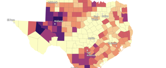
There are already examples of this type of teamwork happening across private and public systems, such as the tag-teaming between the TROPOMI and GHGSat instruments that spotted and quantified a large leak from an oil field in Central Asia last year. And multiple satellites, ground sensors, and emissions modeling were recently used to track methane emissions from a 20-day long blowout in the Eagle Ford Shale in Texas. This served as a stellar example of emissions data integration across the “methane remote sensing ecosystem.”
As satellite capabilities rocket forward, various emissions measurement systems will remain important. For example, ground-based continuous monitoring sensors may be useful near leak-prone sources in areas that are not constantly monitored by highly sensitive satellites. Modeled approaches will also be needed. Among their uses are emissions projections of yet-to-be-built projects and to inform satellites with aim-and-shoot capabilities where to look. In the same Eagle Ford blowout study, a model called the Oil Climate Index was used to simulate emissions consistent with satellite observations, which shows additional utility in understanding emissions from oil and gas accidents and routine operations.
At Climate Week 2020, RMI launched the Climate Action Engine, a first-of-its-kind data and insights platform that collects and assimilates all forms of methane and other GHG data from various emissions sources. These data, once attributed to their sources and analyzed, can be made public. With greater data transparency and access, we can develop solutions that companies and regulators need to combat climate change. Increasing pressure from investors on companies to reduce emissions is providing a push to move environmental, social and governance work out of a sustainability silo and into day-to-day operations. Satellites provide one important data piece for the climate solutions puzzle.


Related Insights
The World Wastes More Gas Each Year Than the Strait of Hormuz Supplies

Help build the clean energy future. Donate today.
Independent research. Real-world solutions. Supported by donors.
RMI can pursue the highest-impact climate and energy solutions because we’re supported by people who believe change is possible. Every gift helps advance the work needed to make clean energy the default choice worldwide.
For other ways to give to RMI, including checks or gifts of stock, please visit Other Ways to Give.