ArcGIS StoryMap

Report | 2023
City Climate Intelligence: Addressing the Urban Emissions Information Gap
How a new, near-real-time GHG estimation methodology can help cities monitor, analyze, and act on emissions data.
More than ever, local governments are committing to bold and ambitious greenhouse gas emissions reductions. Although setting targets is an important first step in the fight against climate change, cities find it hard to mitigate what they cannot estimate.
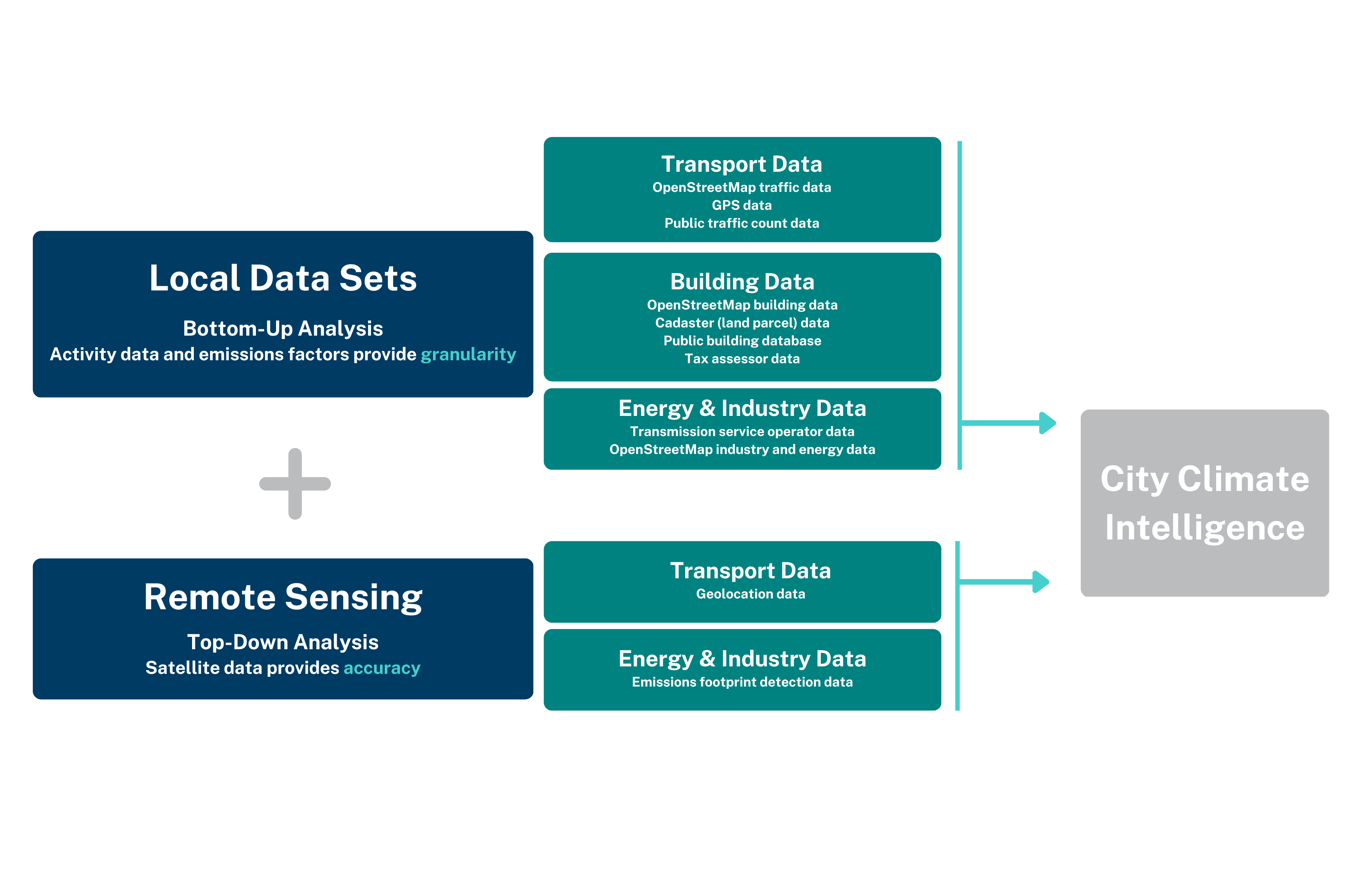
To support these local efforts, Carbon Monitor, Hestia, IG3IS, NEXQT, and RMI collaborated to develop City Climate Intelligence (CCI). CCI is the world’s first near-real-time, high-resolution urban greenhouse gas monitoring methodology that combines local data sets and advanced analytics to deliver better emissions data awareness and insights.
The CCI methodology analyzes emissions information at three spatial scales: Tier 1 (the metropolitan area level), Tier 2 (the neighborhood level), and Tier 3 (the building and street level). The insights generated by CCI can support a cycle of awareness, action, and accountability that engages everyone involved in the city climate ecosystem. The CCI methodology and data are intended to be used by anyone who contributes to this collaborative cycle, including city managers, community-based organizations, citizens, journalists, the climate finance community, and others. This framework provides a foundation for understanding local climate progress.
The City Climate Intelligence: Addressing the Urban Greenhouse Gas Emissions Information Gap report explains how and why we developed the CCI methodology, shows how communities and local governments can leverage its insights, and provides case studies of how cities can leverage CCI data in their work.
How City Climate Intelligence (CCI) Uses an Integrated Bottom-Up and Top-Down Approach to Estimate Urban Greenhouse Gas Emissions

Interested in additional CCI resources or case studies? Check out these resources:
ArcGIS StoryMap
ArcGIS StoryMap
Website
Methodology


